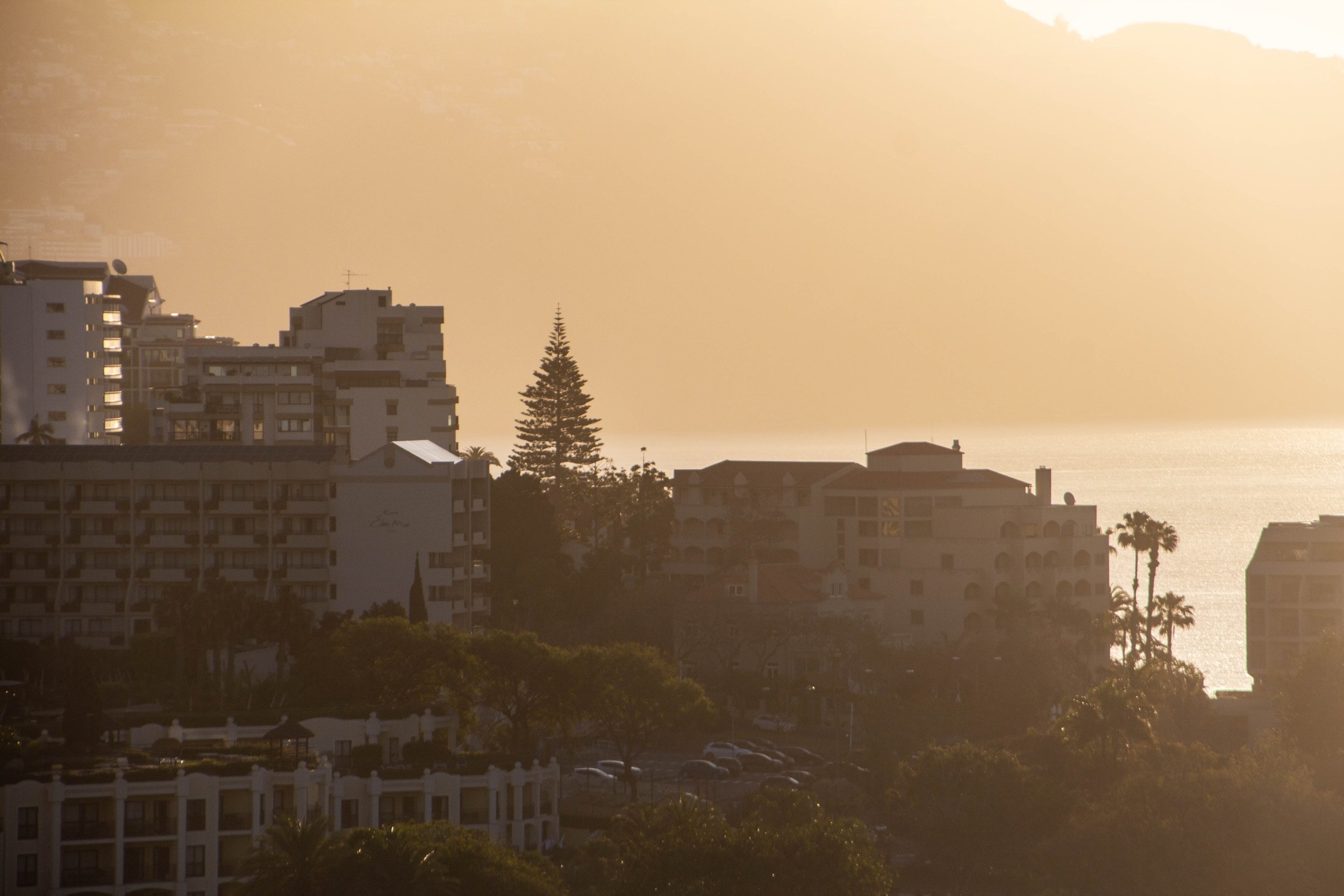
Ok ma peeps. It’s time for the last article from Madeira. And in this one, I am going to run up against some limitations. You see, my travel companion & BFF who had flown from America’s west coast to London a week earlier had showed up with a cold, and in this article, I finally succumb to the seductive advances of his germs and fall ill myself. It probably didn’t help that we ended up unexpectedly sharing a bed in Naples. 😂 There was actually one day in Madeira where I just laid in bed and watched Oppenheimer.
Mission: Improbable
Climb Pico Ruvio With A Cold

The #1 rated hike in Madeira on AllTrails is the one that from Pico do Arieiro to Pico Ruivo. These are the two highest peaks on Madeira. And in the middle you pass over Madeira’s 3rd highest peak: Pico das Torres. AllTrails ranks this hike as “Hard” and I think most people who do it would agree. But there’s some serious hype around this trek!
“It’s gonna be the coolest hike of your life” my friend said to me confidently after we landed in Madeira.
“…Like, my life specifically?” **Subtext: “You don’t think I’ve done any other cool hikes?” 🥺
“No, dude, like the coolest hike of anyone’s life.”
Yeah, the pictures he had shown me made it look pretty amazing. If you type the names of these peaks into Google images, you will see some insane photos. The move—apparently—is to arrive at the trail head just before sunrise so you can watch the sun come up throughout the duration of the hike. The trail head is actually at Pico do Arieiro. You then descend ways before reascending to Pico das Torres, and after that you descend and reascend again to Pico Ruivo. After that, you turn around and do it all over again on the way back. The total elevation gain along the way is 1,313 meters (4,308 feet), and the tallest peak sits at an altitude of 1,845 meters (6,054 feet), which is definitely high enough that you’ll feel the altitude.
It might not seem all that crazy when you compare it against other mountain peaks, but most other mountains sit somewhat inland and thus their starting point often already at an elevation. Because Madeira is an island, these mountains go from literally 0—sea level—to to these heights over hardly any space at all. Madeira is not a big island, after all. Here’s the skinny from AllTrails. 👇👇
SooO0oOoOo… with a bad cold… to hike or not to hike? I decided to make a game-time decision on the matter. So on our first night in Madeira we set our alarms for like 3:30am and packed our bags with snacks for the trip. The weather the next day was set to be absolutely perfect. Here we go!
Attempt #1
Plot twist… the parking garage where we parked our rental LOCKED OUR CAR IN OVERNIGHT. It wasn’t going to re-open until 8am, by which point we would have missed sunrise by quite a bit.

So… let that be a lesson to you. If you want to do a sunrise hike, find street parking.
Frustrated, we resolved to try again the next day.
Attempt #2
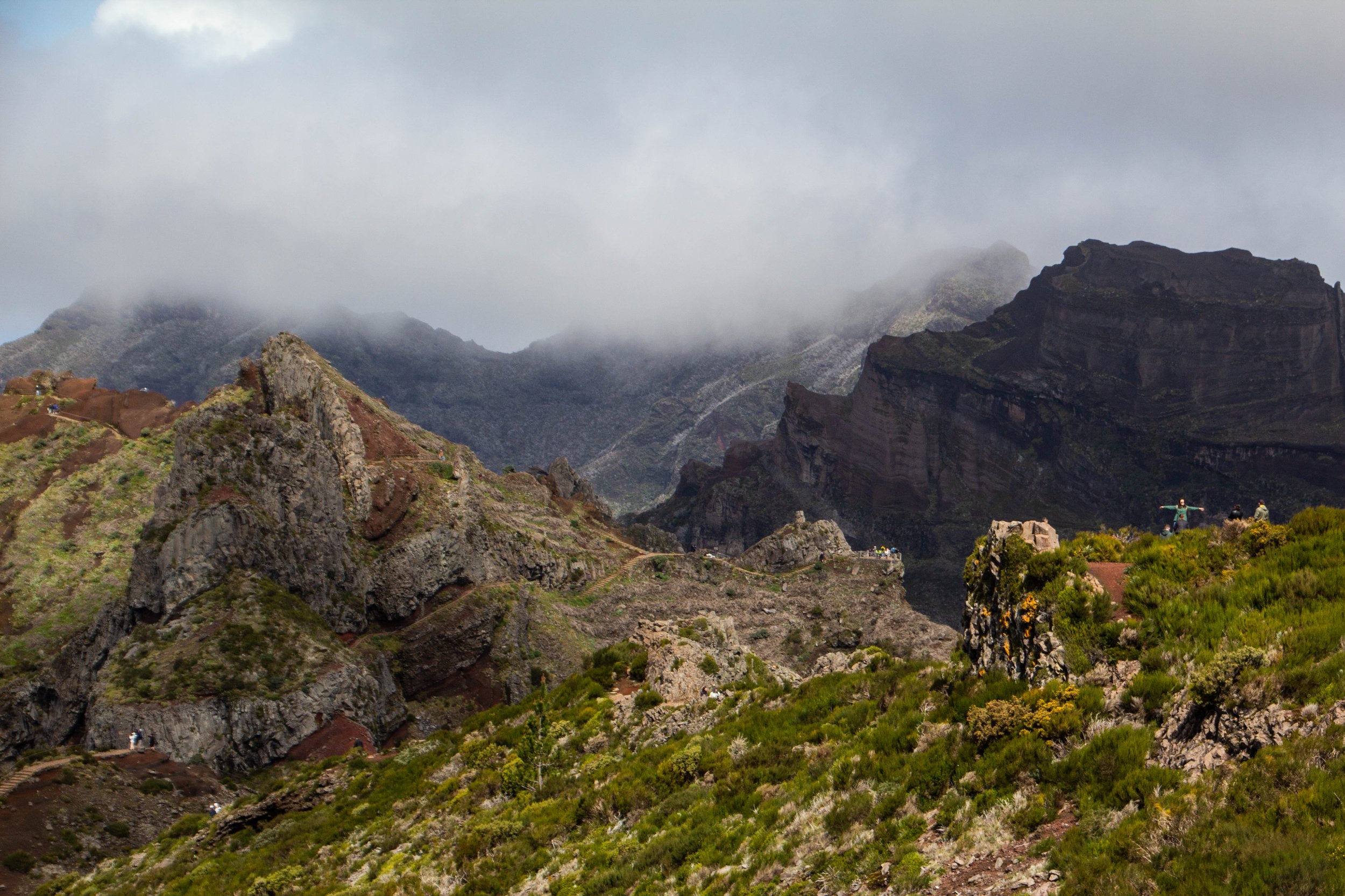
We parked on the street this time, so there was nothing that could stop us! Except, potentially, inclement weather. The previous day had been gorgeous… but by that night an ominous swirl of clouds had formed at the top of Madeira. We crossed our fingers that the clouds would clear overnight, but they didn’t. But we decided to give it a try anyway. After all, clouds could make for some really dramatic views! So we hopped in the car and set out. It was about a 45 minute drive up the side of a mountain to get to the trailhead. And it was also the middle of the night, as we were aiming to arrive at the trailhead before sunrise.
Even in the pre-dawn darkness, the views were beginning to get REALLY dramatic… until we reached the clouds. From that point on, the visibility dropped to almost nothing beyond the road in front of our car. It might have been a bit disorienting if we hadn’t soon found ourselves in a caravan of cars who were all presumably attempting the same thing. So there was a line of red brake lights stretching out ahead of us to guide our sleigh like Rudolph the Red-Nosed Reindeer. There were definitely moments in this drive when it seemed that we must have been driving on the side of massive cliff, but of course we couldn’t see it.


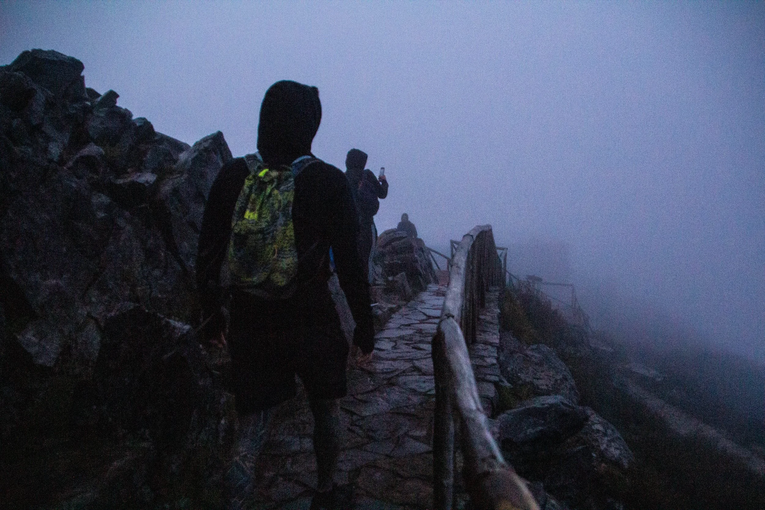
By the time we rolled into the parking lot of the trailhead, it was pretty clear that no hike was going to happen that morning. Before we even opened the car doors, the winds were blowing so fiercely that the parked car was actually rocking on its wheels. Nevertheless, we climbed out of the car into the frigid-cold mountain winds. And when I say cold, I mean COLD. Visibility at almost zero, we climbed up to the trailhead through the fog. This was Pico do Arieiro, the 2nd highest peak in Madeira. And once we were standing at the actual peak, the winds were even stronger and colder than they had been before. This would have been really dangerous to hike through, not to mention completely pointless because the views would not be visible to us. So, after a few minutes of deliberation, we headed back down the mountain. 🥲


Attempt #3
Not to be deterred, we came back a 3rd time—ON OUR WAY TO THE AIRPORT.
We had an evening flight back to London, so we packed our bags, threw them in the car, and got back on the road for a FINAL attempt. For logistical reasons, this was not at sunrise, at had been the original aspiration. There were still clouds circling ominously around us, but despite the constant threat of precipitation, odds seemed good. And the drive back up to the trail head was quite clear compared to our last attempt.
Looking upward at the slopes of Madeira from sea level, although the terrain is impressive, it’s hard to comprehend JUST HOW dramatic the views from the drive were going to be. I couldn’t believe just how high above the water we got, nor how quickly we got there. The average incline angle coming up from sea level must be like 50 degrees or more. The roads, though windy and precarious at times, were smooth and well maintained. Here are some shots from the ascent.


This is where I tap out. A few days of illness had done a number on me. And with the limited window of time we had to get this done, I gave my marathon-runner travel companion my blessings to go for speed on this trail and leave me behind. We needed to be relatively quick in order to make our flight anyway. So while he was off speed-walking the full length of this trail, I got lunch at the the little restaurant at the trail head, and then took a more leisurely pace with the first part of the trail, stopping to appreciate the scenery, take pictures, and smell the proverbial roses. I think I knew that—although there were legitimate reasons for me to tap out—anxiety was playing a role here as well. I always feel like I should be pushing myself, so I wasn’t feeling particularly “macho” about the situation, but I chose to make peace with my decision. The views were still incredibly beautiful.


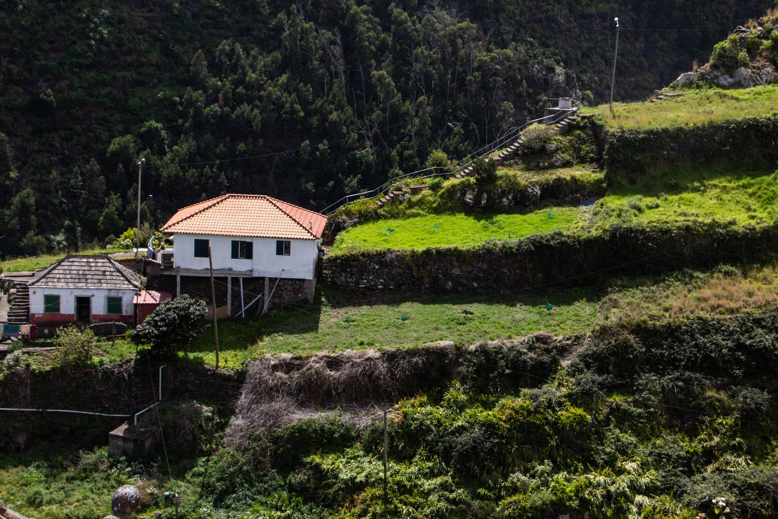
As beautiful as all of this was, to me, the most beautiful little spot that we came across in our ENTIRE time on Madeira was along the drive back down to sea level. We were going a bit of an unusual route because we were going straight from the summit to the airport… and all of a sudden we found ourselves driving down a road that ran along the spine of a mountain ridge. In front of us there always appeared to be an impossibly steep drop-off into the ocean, as it didn’t seem like there would be any other place for the road to go. But as we drove along this precarious ridge, we were passing people’s houses, which were clinging to the hillside in every place that physics would allow. Eventually, however, the drops on either side of the road became so steep that the houses stopped and we got some really dramatic views out over the green valleys below us on either side.
There was clearly some agricultural work happening in the area, but in some places the hills were so steep that people had built in rice-paddies into them like Vietnam or Indonesia. In Europe this felt very out of place… but then again, Madeira isn’t all that European. It’s just a beautiful island out here in the middle of the ocean that happens to have Europeans living on it.
Since we were alone out here, we parked the car in the middle of the road and took some time to walk around and appreciate the moment. It’s random… it’s not a destination you’ll find in any guide, but I think this little spot was my favorite place I found in the entire duration of my time on Madeira. The more I travel, the more clear it becomes that it’s actually the unexpected spaces in-between the tourist attractions and itinerary items that make travel so magical. This definitely cemented that insight further into my brain.
Anyway, against all odds, this road did manage to wind us back down to sea-level just a few miles from the airport. How did they build an airport in a place with so little flat space? You wouldn’t notice it from landing at the airport or walking around it in, but it’s actually sitting on a massive concrete plank that is wedged into the mountain slopes on one side, and on the other being held up by enormous concrete pillars. You have drive under these pillars to get to Farol da Ponta de São Lourenço (the previous article) and it was quite otherworldly. For scale, it made me feel like an ant driving under a human overpass. It would make a great level for a mid-2000s computer game.


This wraps up our series both in Madeira, and in Portugal overall. But there’s SO much more in the queue right now. Honestly, I don’t think I’ve had such a long backlog of articles since I started this blog 10 years ago. Lots going on over here. 😳
Up next…. we’re going to a place SO unfamiliar that it will require me to open a whole section of the Places index. Buckle your seat belts kiddos!